This option can be accessed from the Data Analysis option on IFs Main Menu.
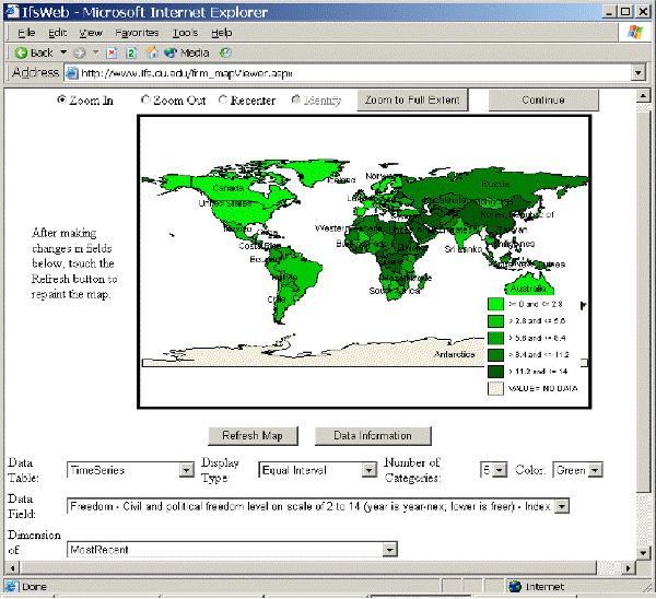
This feature of IFs allows users to display historic data from IFs’ extensive database. The image below is a reproduction of the World Map menu.
The historic data analysis function of the World Map can be found from the Display Data option on the Main Menu. Clicking here will bring up a small menu, which is displayed below.
The Data Table scroll-down list provides broad categories for all of the data tables used in IFs. Choose one of these categories and the variables in the scroll-down list under the heading Variable Name will change. Once you have decided on a variable you would like to display, you are now presented with more options. By far the most extensive data subset is available through the Time Series file.
You can choose what data set (year) you would like to display your data set from the Dimension of Variable scroll down box. You can change the number of display categories by typing in different numbers into the Categories menu box (there is an upper limit of 16 categories and a lower limit of 2 categories). Final, you can alter the numeric distribution of the different categories you choose by selecting Equal Interval, Equal Count or Exact Match from the Display Type scroll down list.